Due to the popularity of the Shirley Spitfire Trail Map, Spitfire Makers were pleased to have worked again with the artist Sarah Silver, to design a Woolston Spitfire Trail Map. The trail map was designed in response to requests from our supporters and the popularity of guided Spitfire walks in the Hazel Road area.
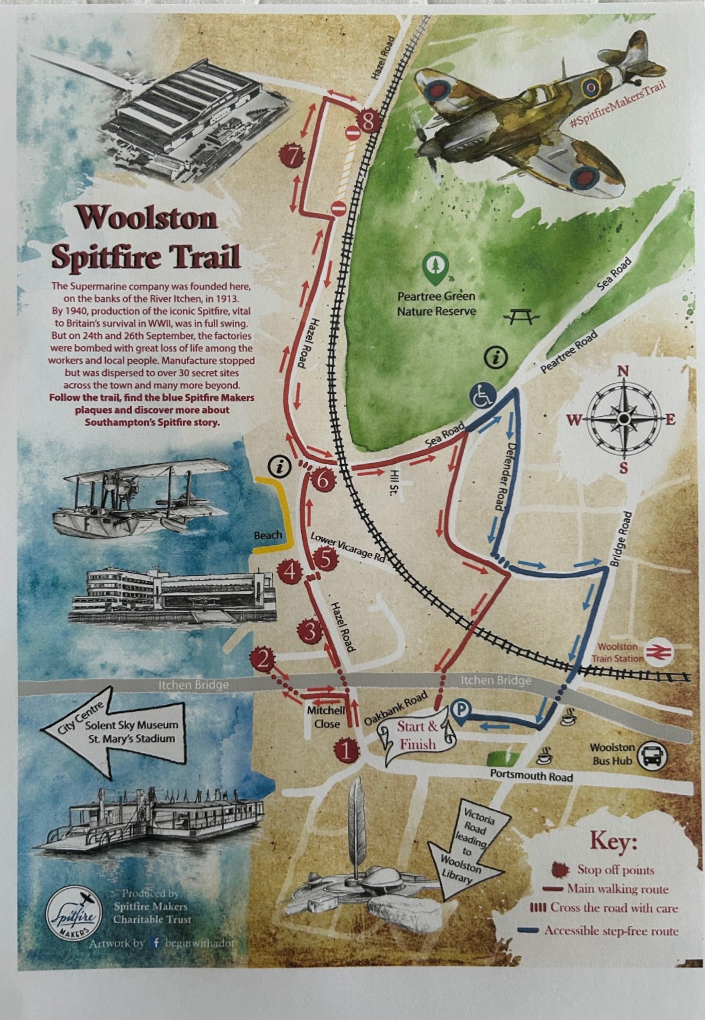
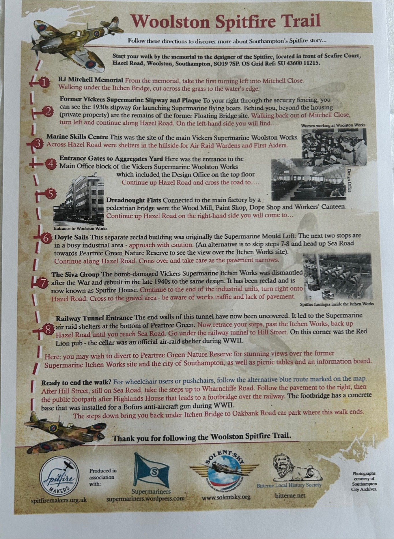
The trail provides people with a self-guided walk taking in the sites along Hazel Road, Woolston, Southampton where the Spitfire was designed and made prior to September 1940. The walk starts and finishes at the beginning of Hazel Road with adequate parking nearby.
Please Note: Hazel Road leads to several small industrial estates and can be very busy on weekdays. It is recommended that this walk is taken at the weekends when the traffic is lighter. We do not recommend the Woolston Spitfire Trail for families with young children due to the volume of traffic in the area.
Our thanks go to:
- Bitterne Local History Group
- Sarah Silver who designed the map – Begin With A Dot Illustration | Facebook
- Dave Key at The Supermariners for supporting information
- Southampton City Archives & Solent Sky Museum for photographs
